Les parcours rando
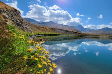
Lacs d'altitude, glaciers et icebergs
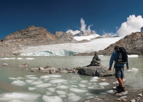
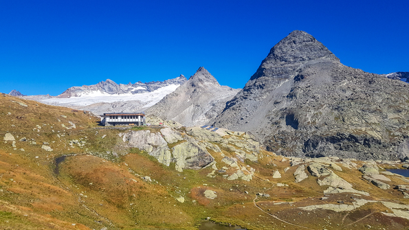
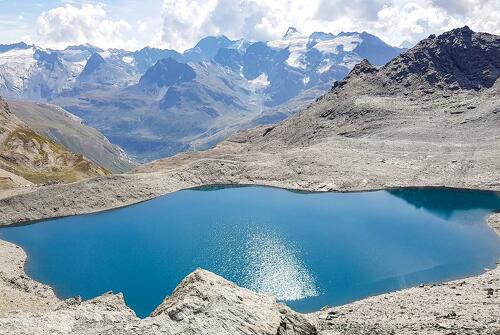
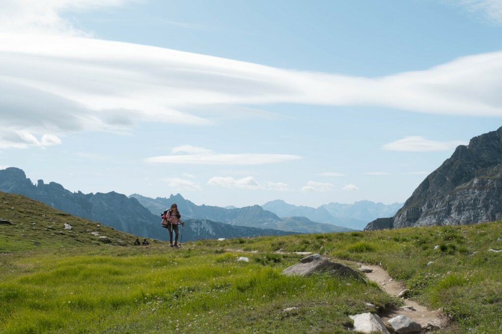
Paysages du bout du monde au coeur des AlpesContemplez les lacs d’altitude le long du sentier balcon jusqu’au refuge du Carro, admirez les glaciers qui surplombent les chemins, profitez du panorama incroyable au Cirque des Evettes et continuez jusqu’au glacier du Grand Méan. Vous en aurez le souffle coupé, non par la montée mais bien par le spectacle de ce glacier qui se termine par une falaise qui plonge dans un lac où flotte des icebergs… Une rando digne des grandes expéditions au bout du monde. Les bouquetins sont aussi souvent présents l’été dans ce secteur. Souvenir à vie garanti !
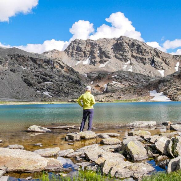
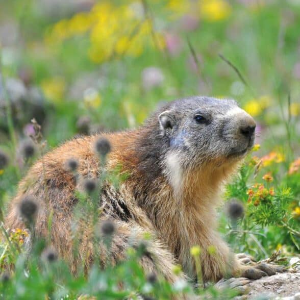
Randos à 3000 et balades marmottes
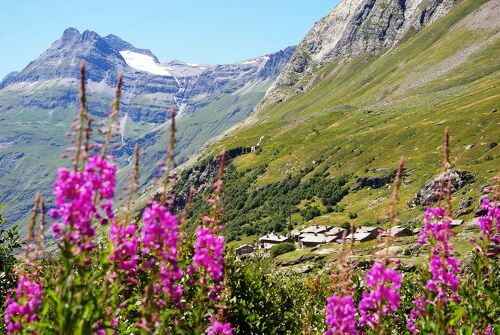
L'emerveillement à quelques minutes de marcheA Bonneval sur Arc, vous pourrez aussi facilement atteindre la barre des “3000”. Côté Iseran et Parc national de la Vanoise, plusieurs randonnées accessibles sans équipement particulier (à partir de mi-juillet, le temps que les névés fondent) permettent d’arriver à 3000 mètres d’altitude très rapidement.
Découvrez les randos “3000” en Haute Maurienne Vanoise.
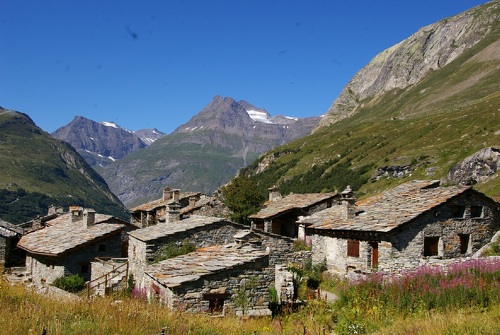
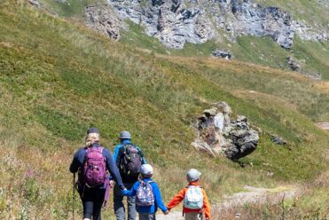
Pour en profiter pleinement et en toute sécurité, laissez-vous guider par nos professionnels de la montagne et partez à la découverte d’un village et d’une vallée légendaire aux paysages magnifiques. A Bonneval sur Arc, vous pourrez aussi en prendre plein les yeux en quelques minutes de marche : marmottes, alpages, torrents, hameaux qui semblent figés dans le temps … N’attendez plus et laissez-nous devenir les complices de vos plus belles échappées…
- Facile-Vert (1)
- Modérée-Bleu (8)
- Assez difficile-Jaune (2)
- Difficile-Rouge (10)
- Très difficile-Noir (4)
-
681Valider
-
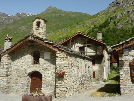
Bonneval-sur-Arc
 randonnee
Tour de Mean Martin – Rando pédestre…
- Distance 81km
- Durée itinérance 5 jours
- Dénivelé positif 3317m
- Dénivelé négatif 3315m
-
Bonneval-sur-Arc
 randonnee
Tour pédestre de Méan Martin en 5 jou…
- Distance 15km
- Durée journalière 05h00
- Dénivelé positif 639m
- Dénivelé négatif 154m
-
Bonneval-sur-Arc
 randonnee
Refuge des Evettes et Lac du grand Mé…
- Distance 14km
- Durée itinérance 2 jours
- Dénivelé positif 1050m
- Dénivelé négatif 1050m
-
Bonneval-sur-Arc
 randonnee
Sentier des sources de l'Arc à pied
- Distance 12.6km
- Durée journalière 04h30
- Dénivelé positif 750m
- Dénivelé négatif 750m
-
Bonneval-sur-Arc
 randonnee
Rando pédestre au refuge du Carro en…
- Distance 10.8km
- Durée journalière 02h30
- Dénivelé positif 5m
- Dénivelé négatif 969m
-
Bonneval-sur-Arc
 randonnee
Boucle du refuge des Evettes à pied
- Distance 9.7km
- Durée journalière 03h00
- Dénivelé positif 580m
- Dénivelé négatif 580m
-
Bonneval-sur-Arc
 randonnee
Boucle pédestre de l'Ecot par les Alo…
- Distance 8km
- Durée journalière 02h45
- Dénivelé positif 270m
- Dénivelé négatif 270m
-
Bonneval-sur-Arc
 randonnee
Traversée pédestre de Méan Martin en…
- Distance 10km
- Durée journalière 04h00
- Dénivelé positif 426m
- Dénivelé négatif 1151m
-
Termignon
 randonnee
Traversée pédestre de Méan Martin en…
- Distance 12km
- Durée journalière 03h30
- Dénivelé positif 275m
- Dénivelé négatif 240m
- 1
- 2
- 3
Pour aller plus loin…
Guide “103 balades et randos, 38 parcours trails”
Découvrez tous les itinéraires trail et randonnée à Valfréjus et en Haute Maurienne Vanoise avec notre Guide (livret balades faciles + livret randonnée et trail + carte) en vente à l’accueil de l’Office de Tourisme.
Guide randos et trails – Escapades en douceur (PDF)
Guide randos et trails – Échappées d’altitude (PDF)
Carte randos et trails (PDF)
Livret préparer sa sortie en montagne (PDF)
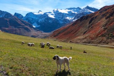
Rencontre avec un Patou : quels sont les gestes à adopter ?
Randonnées itinérantes au cœur des Alpes