Retour
randonnee
Retour
randonnee
Boucle pédestre du balcon du Carro à son refuge
Une nuit dans le plus haut refuge de Savoie ? Voilà une belle aventure à vivre en famille ! Surtout si pour l’atteindre il faut passer par des paysages dignes de décor de cinéma…
Description
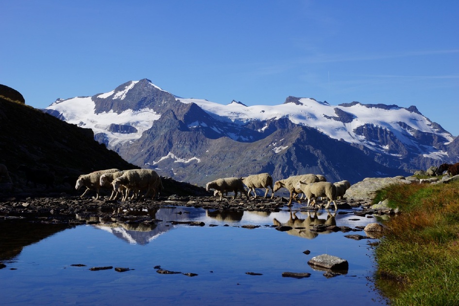
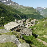
En avançant sur le chemin au milieu des alpages, vous pourrez voir des chalets d’alpages aux formes originales : afin de résister aux avalanches, ils sont semi-enterrés ou protégés par une « tourne », sorte d’étrave de pierre.
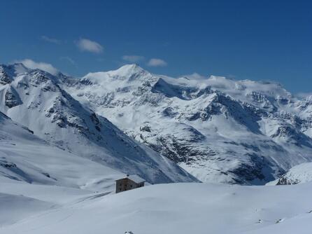
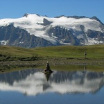
Les glaciers de l’Albaron, du Vallonnet et des Evettes vous font face sur ce sentier en balcon, donnant sur le cirque des sources de l’Arc.
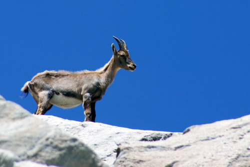
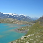
Plusieurs lacs se succèdent le long du chemin. De l’azur au turquoise, les nuances de bleu se répondent, toujours plus surprenantes. Quelques chamois sont visibles au loin.
Vous arrivez alors au refuge, parfaitement intégré dans ce décor minéral. Passez voir les lacs au-dessus. Vous êtes au bout du monde !
C’est l’occasion de passer une nuit tout près des étoiles du ciel pur de haute montagne. Surtout n’oubliez pas de faire un vœu à chaque étoile filante !
En redescendant, attardez-vous au hameau de l’Ecot et à Bonneval-sur-Arc. N’est-ce pas Sébastien que l’on aperçoit courant dans une ruelle, suivi de sa fidèle Belle ?
Complément accueil
La durée des parcours randonnée est calculée à partir d’allures de référence : 300 m/h de dénivelé à la montée, 500 m/h de dénivelé à la descente et 4 km/h sur le plat.
Des aléas pouvant survenir à tout moment sur les parcours, les traces GPX fournies ne sont pas contractuelles. Elles sont données à titre indicatif. Le pratiquant les utilise sous sa propre responsabilité en fonction de son niveau de maitrise des outils technologiques et de sa compréhension du terrain.
-
Age minimum : 12 ans
Environnements
-
 Arrêt de transport en commun à moins de 500 m
-
Arrêt navette à moins de 300 m
-
Vue lac
-
Vue montagne
-
En montagne
-
Dans une réserve naturelle
-
Présence de troupeaux et chiens de protection
Tarifs
Accès libre.
Itinéraire
-
 Distance
22.2km
Distance
22.2km
-
 Type d'itinéraire
Aller simple
Type d'itinéraire
Aller simple
-
 Dénivelé positif
570m
Dénivelé positif
570m
-
 Dénivelé négatif
570m
Dénivelé négatif
570m
-
 Durée journalière
08h00
Durée journalière
08h00
-
 Itinéraire balisé
Oui
Itinéraire balisé
Oui
-
 Précision balisage
Balisage mixte (PR: lames jaune, PNV : bleu-blanc-rouge et GR : rouge et blanc)
Précision balisage
Balisage mixte (PR: lames jaune, PNV : bleu-blanc-rouge et GR : rouge et blanc)
-
 Nature du terrain
Rocher,
Cailloux,
Terre,
Non adapté aux poussettes
Nature du terrain
Rocher,
Cailloux,
Terre,
Non adapté aux poussettes
-
 Altitude maximum
2760m
Altitude maximum
2760m
Période d'ouverture
Du 15/05 au 15/10 tous les jours.
Sous réserve de conditions d'enneigement et météorologiques favorables.
Ouverture complémentaire
-
Sous réserve de conditions météo favorables
-
Sous réserve de conditions d'enneigement
Documents

Animaux
Animaux acceptés : Non
Les animaux ne sont pas admis sur cette randonnée située dans le Parc National de la Vanoise.
Topo/pas à pas
-
Pour vous guider sur le terrain, consultez le schéma directionnel « pas à pas » fourni en pdf.


-
Distance
22.2km
-
Durée journalière
08h00
-
Dénivelé positif
570m
-
Dénivelé négatif
570m